fmMapping 1.5
Direct Impact Solutions Inc.
Summary
Product Type: Apps
Price: Free
Last updated: 5/23/2019
Language: English
Product websiteCategory
fmMapping 1.5
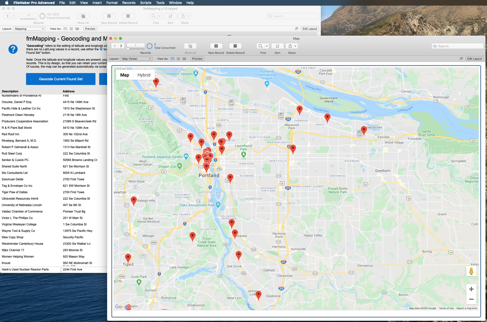
Convert addresses to Lat & Long and show multiple addresses as pins on a map.
Connect your database with Google’s Maps API to find the latitude and longitude for a given set of addresses (geocoding) and then display markers of those coordinates on a single Google map.
Each pin can have a custom color and will display data from your database.
Simple integration can be done in minutes, and we can customize on request.
What's New
Custom color pins, support JSON & FileMaker 18, and more.
Additional resources
Claris product features
See why Claris products are the top choice for developers for their low code needs.
Product resources
Get instant access to helpful resources and start creating custom apps today.